The Impossible (nee Improbable) Traverse of Guy Peak
UPDATE 2022: The Improbable just became Impossible.
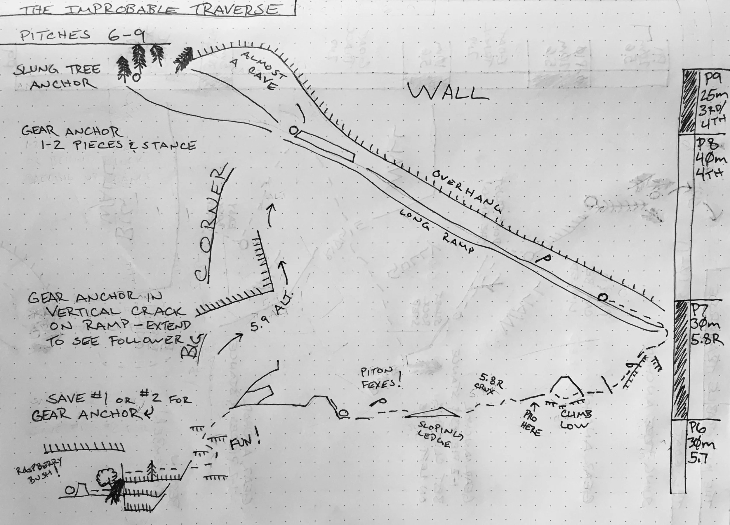
In November 2021 a massive rockfall event occurred on the face above the namesake traverse pitches 7 and 8, removing at least a third of the actual traverse and forever changing the mountain. I think it’s fair to say the Improbable Traverse is no more, but it may be possible to climb the face in some manner by taking the 5.9 alternative up the Big Corner beginning at Pitch 7. I did not get to climb the route this summer and have no idea. If you’re set on adventuring, I recommend speaking with Pro Ski and Mountain Service in North Bend to get the best conditions report possible.
I’m going to leave the route report below available because I’m so damn proud of the work I did to pull it together!
The Improbable Traverse was discovered and climbed in 1960 by Dave Hisser and Mike Borgoff. 60 years later, the climb hasn’t lost any excitement. Today the West Face stares down at the Interstate - some days the sound of traffic can be a bit much. But it still demands carefully route finding and a solid lead head. Grade creep and perhaps FA understatement has bumped up the consensus grade to 5.8, and a few fixed pitons now missing warrant an runout disclaimer.
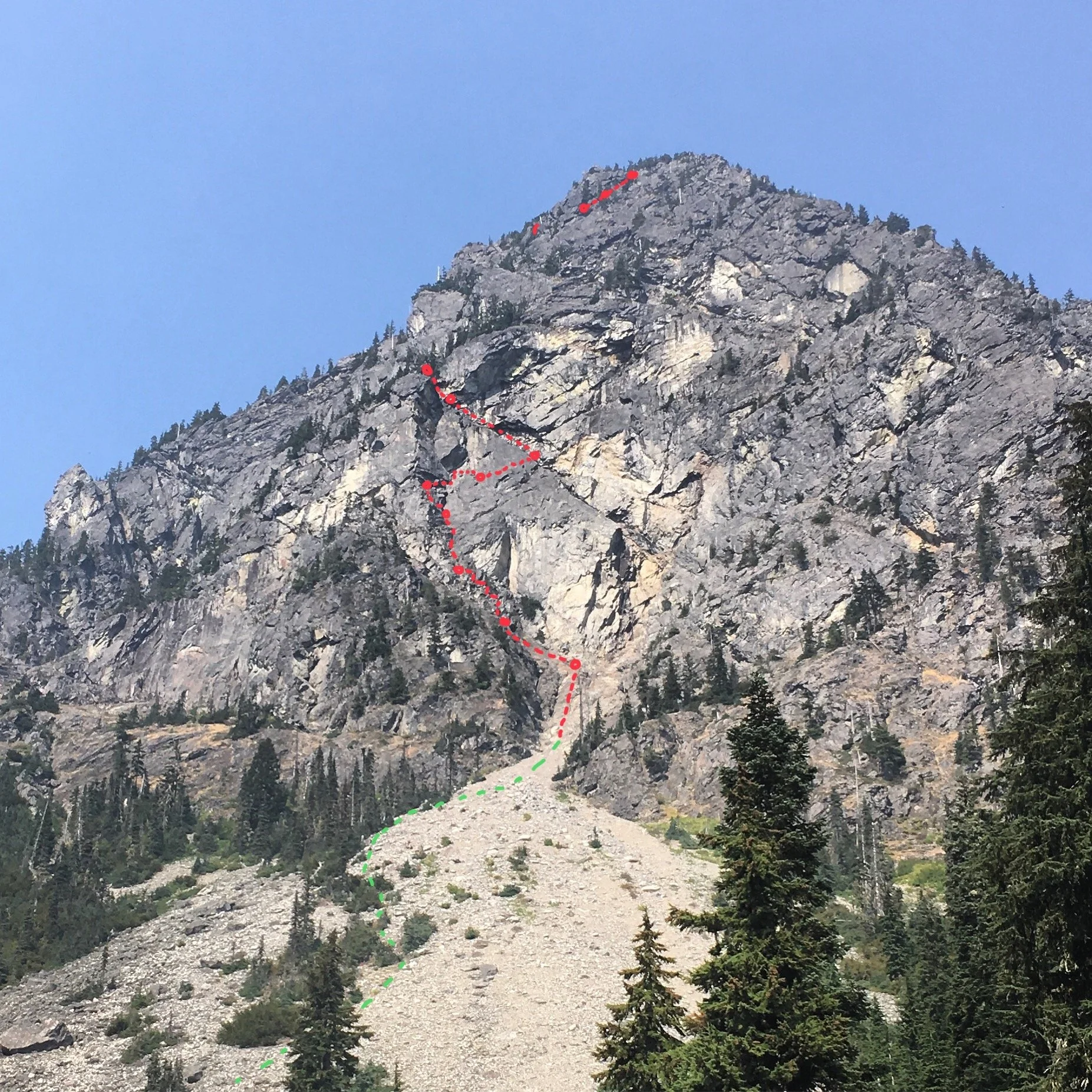
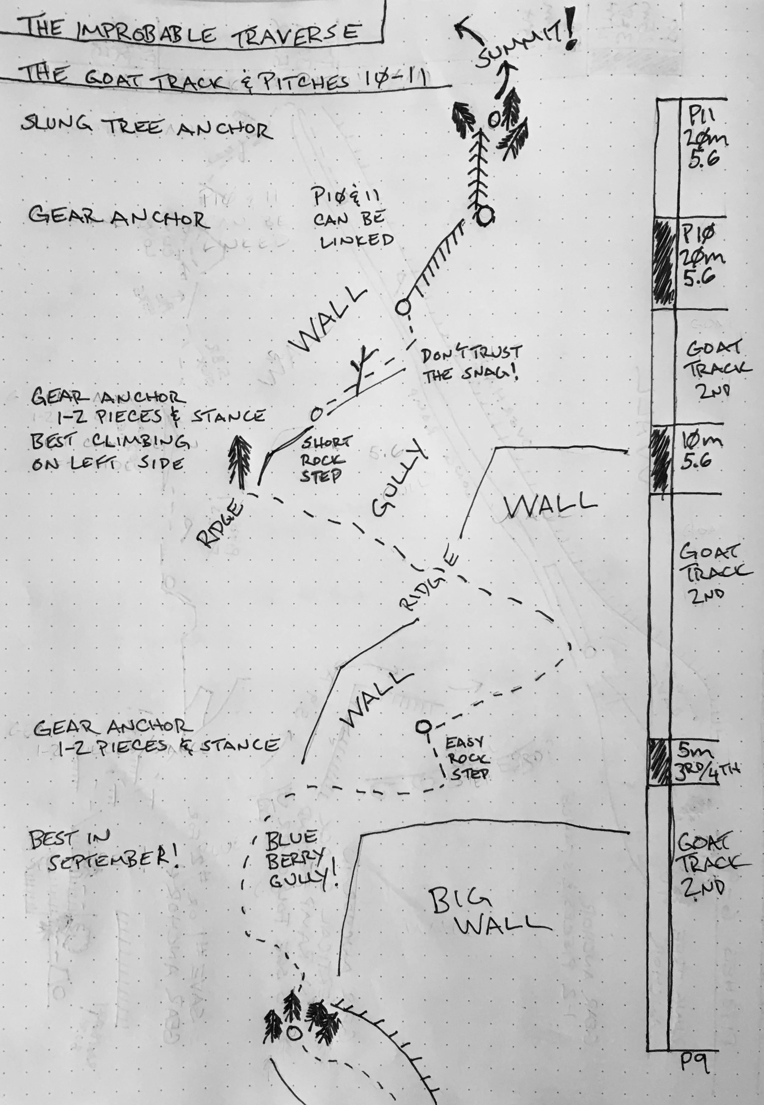
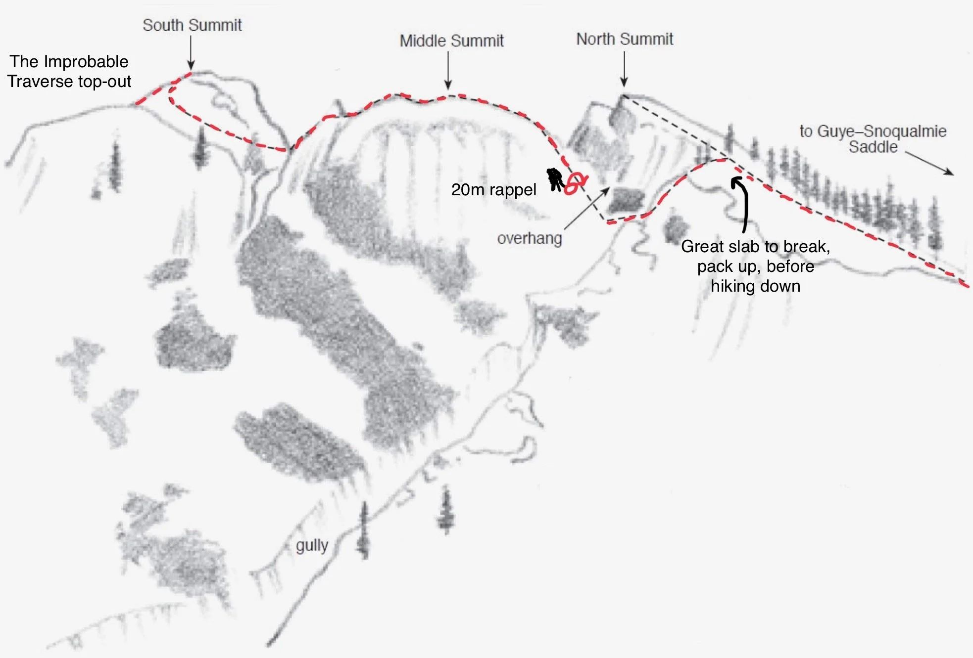
Guye Peak (5168 ft / 1575 m), West Face. The Improbable Traverse, III 5.8R 10 pitches + “goat track” hiking.
Access (0.45 to 1.00 hour from Seattle):
From I-90, head north into Alpental Valley on Erste Strasse. Pass the Sahalie Ski Club cabin on the right and the Washington Alpine Club cabin on the left. It is imperative that you do not park in their parking lots! Creating negative attention will possibly limit future access. Instead, park in the next large lot on the left (@47.4333, -121.4177). If you’ve made it to Ober Strasse or the house across from that intersection, you’ve gone too far. This year, there were two sandwiche-board road signs stating “No Dumping” in the parking lot, but not No Parking. This is the winter-time snowplow dumping lot for the ski area and the village.
Park here, because parking any closer will be on private roads and bring negative attention to climbers, quite likely making future access more difficult.
Alternatively, you can park at the Commonwealth Trailhead or the Snow Lake Trailhead and walk 10-15 minutes to the intersection of Erste Strasse and Ober Strasse, where the approach notes begin.
Approach (0.30-0.45 minutes):
Walk up Ober Strasse until it doglegs back to the south, the talus field just a stone’s throw to the north. In my experience, the residents of Alpental Village are welcoming to hikers providing they don’t attempt to park on the private village roads and don’t walk though anyone’s yard - so don’t do it! There is a private property parcel here that the residents have turned into a fire ring. Absolutely DO NOT PARK YOUR CAR HERE - there is a no parking - no trespassing sign in the middle of the lot. Just behind the fire ring, a short, well-traveled path leads to the talus field. To date, no one has ever chastised me for using this access - let’s be good climbers and make short work of this to minimize negative attention.
Alternatively, if the conditions change or if you’re told you may not cross this property, one could turn left/north onto St Anton Strasse, follow it to the end, and then follow a short trail to the very toe of the talus field.
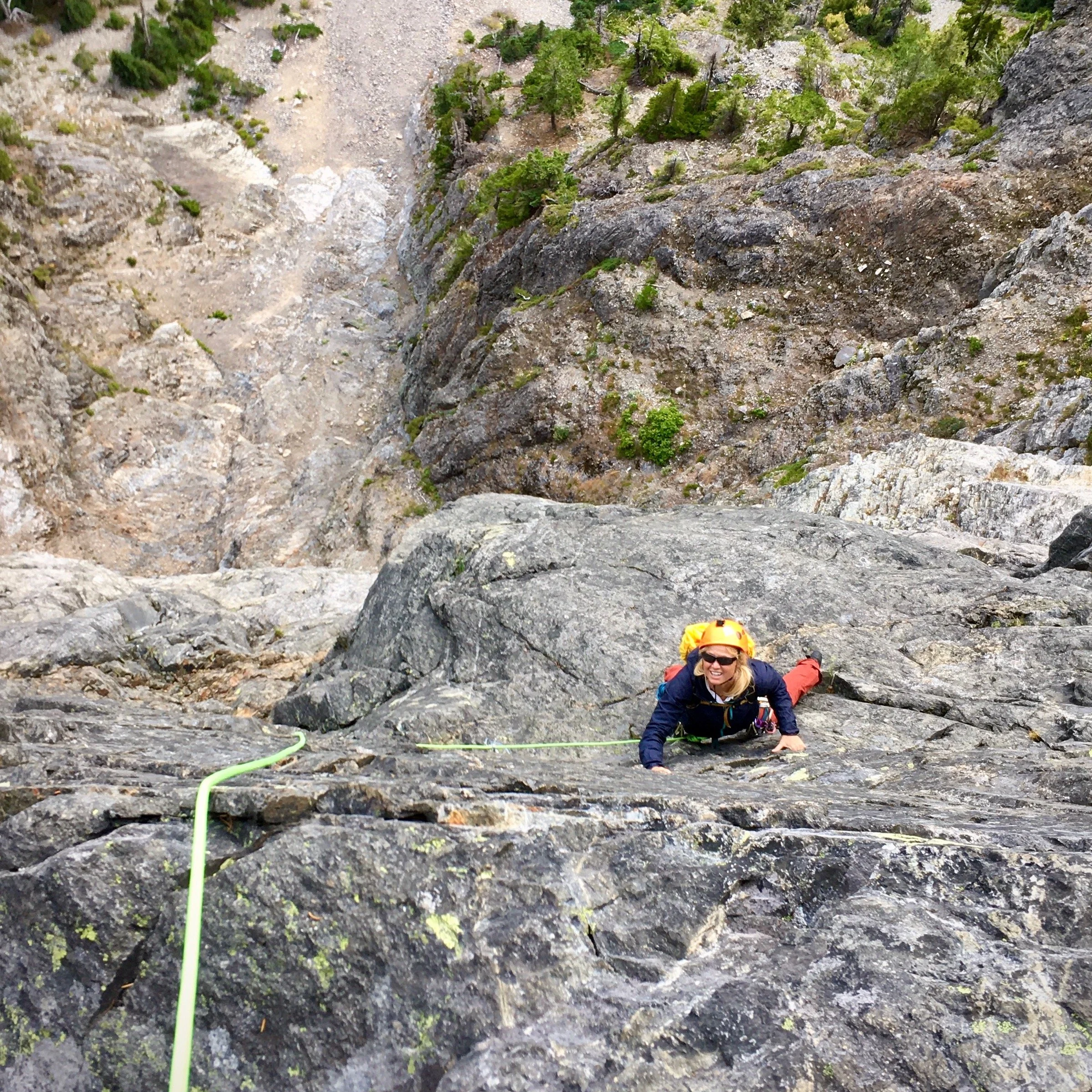
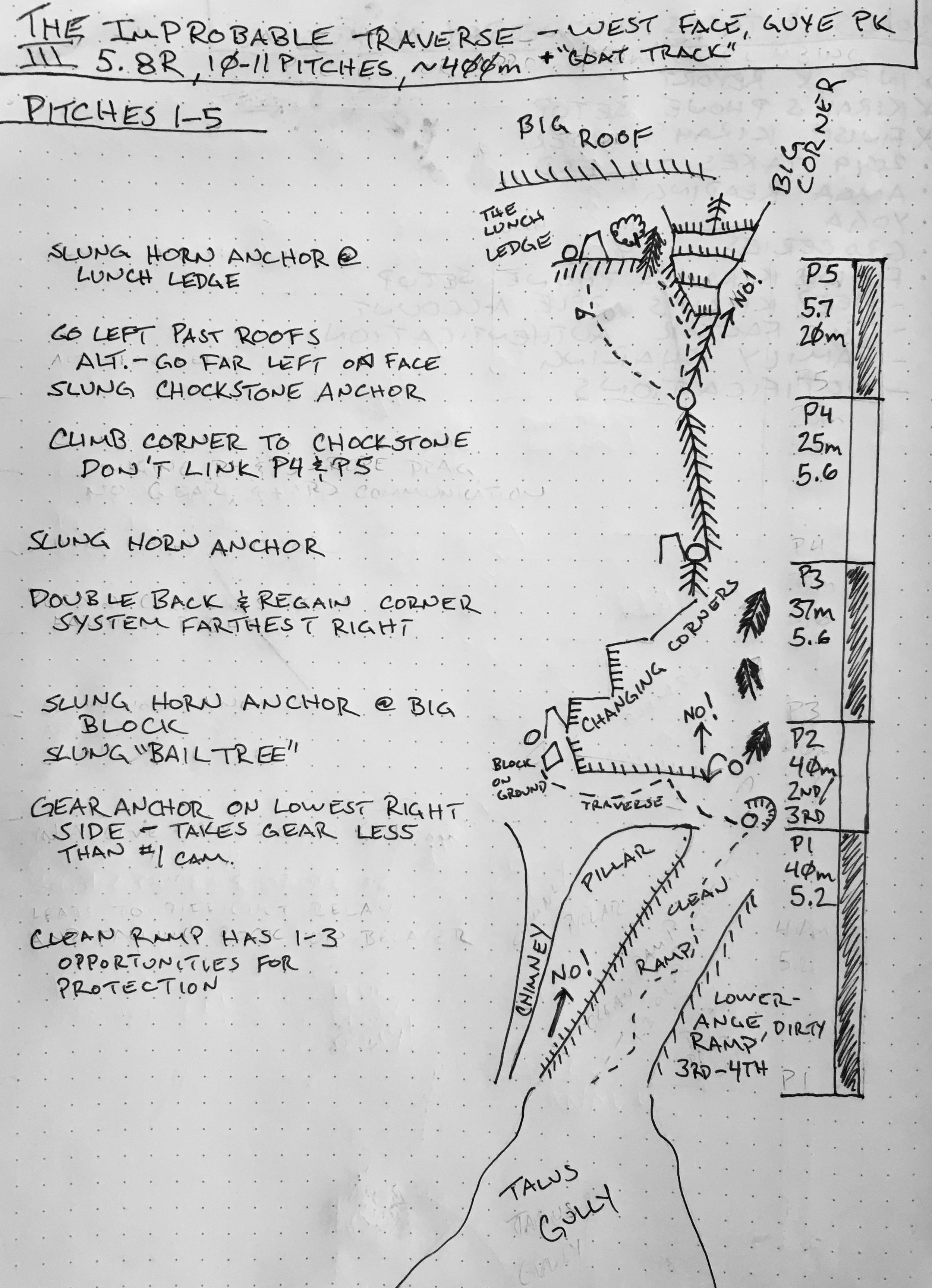
Ascend the talus field into the talus gully at the bottom of the West Face. In the gully and at the very end, ascend exposed slabs/ramps until the talus is completely behind you. A dirty, 3rd of 4th class ramp continues straight up, a cleaner 5.0 ramp to the left, a climbable pillar on the left side, and a deep uninviting chimney to the left of that. You may be able to spy the “bail-off” rappel sling hanging from the first tree at the top of the gully.
Gear:
40m lead line. A 50m, 60m or 70mn will also work, but you will have a lot of unnecessary rope.
1 set of cams, #3-#0.3 (Black Diamond, 7 total)
1 set of stoppers, #10-#4 (Black Diamond, 7 total)
4 shoulder slings with carabiners
4 quickdraws
Two cordellettes or triple-shoulder slings, for slinging the big horn anchors on pitches 2, 3, and 5.
Individual gear (helmets, locking carabiners, belay devices, etc) is assumed and not listed here, deferring to your personal preference.
The rope and entire rack - a little less than 10 pounds total..
Emergencies:
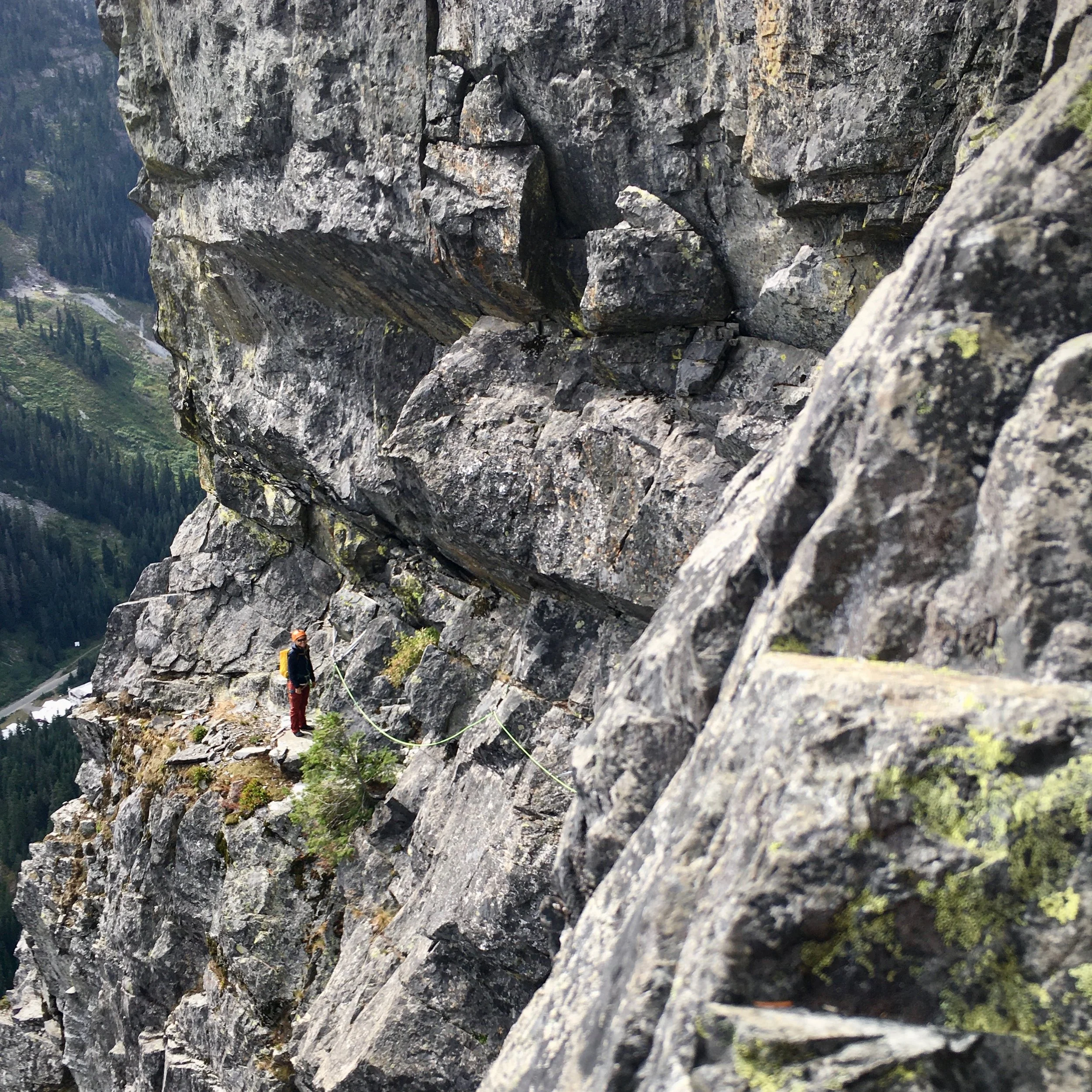
Cell phone coverage is good throughout this climb. Keep in mind that if you call for a rescue from the top of Pitch 5 (The Lunch Ledge) to the end of pitch 9, the roofs above prevent a helicopter rescue (it’s been attempted). Mountain Rescue will have to climb up to your location instead.
